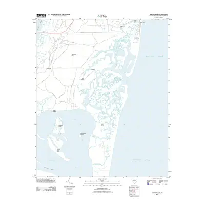
2011 Map of North Island
USGS Topo · Published 2011About this map
North Island and the marshes of Waccamaw Neck define this South Carolina coastal landscape where the Waccamaw River meets the Atlantic. The intricate network of tidal creeks, including Debidue Creek and Bread and Butter Creek, surrounds barrier features like Debidue Island and the Pumpkinseed Islands. At the northern edge, the residential layout of De Bordieu Colony contrasts with the undeveloped expanses of Mud Bay and the Marsh Islands.
Find a feature on this map
63 named features on this map. Tap any name to fly to it.
Don’t see what you’re looking for? This feature index may not catch every label — zoom into the map to look around manually.
Map Details
Editions of this 2011 North Island Map
This is the sole edition of this map. No revisions or reprints were ever made.
Other maps of this area

1942 · Santee Point
USGS Topo · 1:24,000

1942 · North Island
USGS Topo · 1:24,000

1942 · Magnolia Beach
USGS Topo · 1:24,000

1942 · Waverly Mills
USGS Topo · 1:24,000

1943 · Georgetown North
USGS Topo · 1:24,000

1943 · Minim Island
USGS Topo · 1:24,000

1943 · Georgetown South
USGS Topo · 1:24,000

1947 · Georgetown South
USGS Topo · 1:24,000

1949 · Georgetown
USGS Topo · 1:250,000

1967 · Georgetown
USGS Topo · 1:250,000