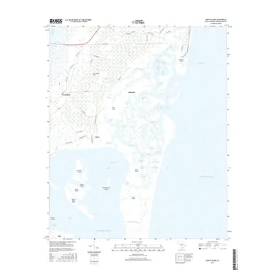
2017 Map of North Island
USGS Topo · Published 2017About this map
Waccamaw Neck and the surrounding barrier islands form a complex labyrinth of marshes and tidal creeks along this stretch of the South Carolina coast. The landscape is defined by the shifting boundaries of water and land, where the Intracoastal Waterway cuts through the western wetlands near Friendfield. The map reveals a transition from the structured residential developments at Debidue Island to the strictly natural preserves of North Island. Between these points, a network of named waterways like Bread and Butter Cr, No Mans Friend Creek, and Old Man Creek weave through the Pumpkinseed Islands and Goat Island. Small settlements and named landings such as Clambank and Caines provide evidence of human activity in an area dominated by the tides and the expansive North Inlet.
Find a feature on this map
79 named features on this map. Tap any name to fly to it.
Don’t see what you’re looking for? This feature index may not catch every label — zoom into the map to look around manually.
Map Details
Editions of this 2017 North Island Map
This is the sole edition of this map. No revisions or reprints were ever made.
Other maps of this area

1942 · Santee Point
USGS Topo · 1:24,000

1942 · North Island
USGS Topo · 1:24,000

1942 · Magnolia Beach
USGS Topo · 1:24,000

1942 · Waverly Mills
USGS Topo · 1:24,000

1943 · Georgetown North
USGS Topo · 1:24,000

1943 · Minim Island
USGS Topo · 1:24,000

1943 · Georgetown South
USGS Topo · 1:24,000

1947 · Georgetown South
USGS Topo · 1:24,000

1949 · Georgetown
USGS Topo · 1:250,000

1967 · Georgetown
USGS Topo · 1:250,000