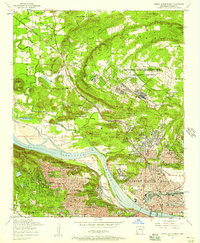
1954 Map of North Little Rock
USGS Topo · Published 1975About this map
The National Guard Training Area (Camp Joseph T Robinson) dominates the northern landscape of this mid-century survey, surrounded by established community landmarks and family homesteads. The Arkansas River serves as the primary geographic divider, with North Little Rock and Little Rock showing significant urban development connected by the Broadway Bridge and Main Street Bridge. Industrial and transit corridors are defined by the Missouri Pacific Yards and the Chicago Rock Island and Pacific rail lines, which supported the region's mid-century growth.
Find a feature on this map
52 named features on this map. Tap any name to fly to it.
Don’t see what you’re looking for? This feature index may not catch every label — zoom into the map to look around manually.
Map Details
Editions of this 1954 North Little Rock Map
This is the sole edition of this map. No revisions or reprints were ever made.
Other maps of this area

1891 · Little Rock
USGS Topo · 1:125,000

1893 · Little Rock
USGS Topo · 1:125,000

1935 · Mc Almont
USGS Topo · 1:24,000

1935 · Little Rock
USGS Topo · 1:24,000

1935 · Sweet Home
USGS Topo · 1:24,000

1935 · North Little Rock
USGS Topo · 1:24,000

1935 · Alexander
USGS Topo · 1:48,000

1941 · Alexander
USGS Topo · 1:62,500

1941 · Olmstead
USGS Topo · 1:31,680

1943 · Pinnacle Mtn
USGS Topo · 1:31,680