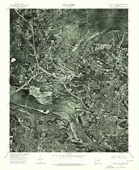
1975 Map of North Little Rock
USGS Topo · Published 1976About this map
North Little Rock and the surrounding riverfront appear in high detail in this 1975 orthophotomosaic, which uses aerial photography to document the urban and industrial expansion of the mid-1970s. The image-based format provides a precise view of the neighborhood layouts, commercial corridors, and the winding course of the Arkansas River before later decades of development further altered the city's footprint. By focusing on the literal photographic record rather than traditional line-and-symbol cartography, this survey captures the exact density of trees, the specific alignment of highway interchanges, and the industrial infrastructure bordering the water. It serves as a vital record for those studying the physical evolution of Central Arkansas during a period of significant suburban growth and infrastructural modernization.
Find a feature on this map
2 named features on this map. Tap any name to fly to it.
Don’t see what you’re looking for? This feature index may not catch every label — zoom into the map to look around manually.
Map Details
Editions of this 1975 North Little Rock Map
This is the sole edition of this map. No revisions or reprints were ever made.
Other maps of this area

1891 · Little Rock
USGS Topo · 1:125,000

1893 · Little Rock
USGS Topo · 1:125,000

1935 · Mc Almont
USGS Topo · 1:24,000

1935 · Little Rock
USGS Topo · 1:24,000

1935 · Sweet Home
USGS Topo · 1:24,000

1935 · North Little Rock
USGS Topo · 1:24,000

1935 · Alexander
USGS Topo · 1:48,000

1941 · Alexander
USGS Topo · 1:62,500

1941 · Olmstead
USGS Topo · 1:31,680

1943 · Pinnacle Mtn
USGS Topo · 1:31,680