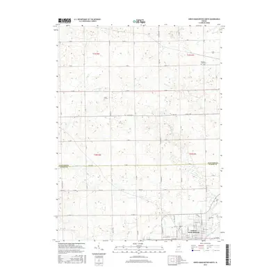
2016 Map of North Manchester North
USGS Topo · Published 2016About this map
North Manchester anchors the southern edge of this map, positioned where the Eel River winds through the landscape. The town's academic roots are visible at Manchester Coll, while the surrounding rural landscape in Wabash and Kosciusko Counties is defined by a grid of country roads and scattered family cemeteries. Significant local burial sites including Oaklawn Cem, Clemmers-Fishers Cem, Gospel Hill Cem, and Swank Cem provide valuable touchstones for genealogists tracing early residents of the region. The terrain is marked by several water bodies, such as Beigh Lake and the meandering paths of Trimble Cr and Plunge Cr, which illustrate the natural drainage patterns that have influenced agricultural development and settlement since the area was first surveyed.
Find a feature on this map
14 named features on this map. Tap any name to fly to it.
Don’t see what you’re looking for? This feature index may not catch every label — zoom into the map to look around manually.
Map Details
Editions of this 2016 North Manchester North Map
This is the sole edition of this map. No revisions or reprints were ever made.
Other maps of this area

1950 · Pierceton
USGS Topo · 1:24,000

1953 · Fort Wayne
USGS Topo · 1:250,000

1953 · Muncie
USGS Topo · 1:250,000

1956 · Muncie
USGS Topo · 1:250,000

1956 · Fort Wayne
USGS Topo · 1:250,000

1957 · Warsaw
USGS Topo · 1:24,000

1961 · Silver Lake
USGS Topo · 1:24,000

1961 · Roann
USGS Topo · 1:24,000
1961 · Servia
USGS Topo · 1:24,000
1961 · North Manchester South
USGS Topo · 1:24,000