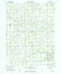
1961 Map of Servia
USGS Topo · Published 1963About this map
The Erie-Lackawanna railroad cuts a diagonal path through this rural landscape on the border of Wabash and Huntington Counties. The settlement of Servia serves as a local hub near the western edge, while Bippus marks the eastern extent of the surveyed area. This early 1960s landscape is defined by its agricultural character, evidenced by the numerous family-named roads like Myers Road and Klutz Road, and the presence of small rural airfields such as Servia Landing Field and Shaffer Landing Field.
Find a feature on this map
33 named features on this map. Tap any name to fly to it.
Don’t see what you’re looking for? This feature index may not catch every label — zoom into the map to look around manually.
Map Details
Editions of this 1961 Servia Map
3 editions found
Other maps of this area

1950 · Lagro
USGS Topo · 1:24,000

1950 · Andrews
USGS Topo · 1:24,000

1951 · Andrews
USGS Topo · 1:24,000

1951 · Lagro
USGS Topo · 1:24,000

1952 · Wabash
USGS Topo · 1:24,000

1953 · Fort Wayne
USGS Topo · 1:250,000

1953 · Muncie
USGS Topo · 1:250,000

1955 · Bippus
USGS Topo · 1:24,000

1956 · Muncie
USGS Topo · 1:250,000

1956 · Fort Wayne
USGS Topo · 1:250,000