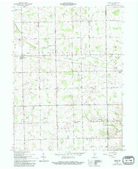
1961 Map of Servia
USGS Topo · Published 1994About this map
Servia and Bippus anchor this rural landscape along the boundary of Wabash and Huntington Counties. The terrain is defined by a dense network of local watercourses, including Pony Creek, Beargrass Creek, and Paw Paw Creek, which dictate the placement of early infrastructure. The map reveals a deeply settled agricultural community where family-named roads like Myers Road, Klutz Road, and Ulrey Road connect scattered homesteads to local centers of worship and remembrance.
Find a feature on this map
39 named features on this map. Tap any name to fly to it.
Don’t see what you’re looking for? This feature index may not catch every label — zoom into the map to look around manually.
Map Details
Editions of this 1961 Servia Map
3 editions found
Other maps of this area

1950 · Lagro
USGS Topo · 1:24,000

1950 · Andrews
USGS Topo · 1:24,000

1951 · Andrews
USGS Topo · 1:24,000

1951 · Lagro
USGS Topo · 1:24,000

1952 · Wabash
USGS Topo · 1:24,000

1953 · Fort Wayne
USGS Topo · 1:250,000

1953 · Muncie
USGS Topo · 1:250,000

1955 · Bippus
USGS Topo · 1:24,000

1956 · Muncie
USGS Topo · 1:250,000

1956 · Fort Wayne
USGS Topo · 1:250,000