2011 Map of North Manitou Island OE E
USGS Topo · Published 2011About this map
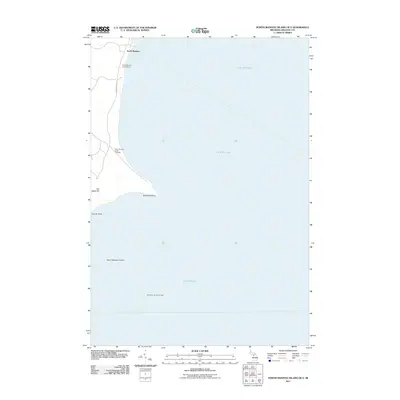
Lake Michigan surrounds the eastern reaches of an isolated island landscape in this 2011 survey. The settlement of North Manitou stands as the primary human footprint on the northern shore, where local history is anchored by the North Manitou Island School and the North Manitou Island Cemetery. The map captures the meeting of land and water at points like Dimmicks Point and Donner Point, while the prominent Old Baldy Hill rises above the coastline. To the south, the treacherous North Manitou Shoals are marked by the North Manitou Shoal Light, a critical navigational aid for vessels traversing these waters. This edition provides a precise look at the island's geography following its incorporation into national protected lands, preserving the locations of its historic community structures and natural landmarks.
Find a feature on this map
10 named features on this map. Tap any name to fly to it.
Don’t see what you’re looking for? This feature index may not catch every label — zoom into the map to look around manually.
Map Details
Editions of this 2011 North Manitou Island OE E Map
This is the sole edition of this map. No revisions or reprints were ever made.
Other maps of this area

1954 · Traverse City
USGS Topo · 1:250,000

1954 · Escanaba
USGS Topo · 1:250,000

1954 · Manitowoc
USGS Topo · 1:250,000

1955 · Cheboygan
USGS Topo · 1:250,000

1956 · North Manitou
USGS Topo · 1:62,500

1957 · Escanaba
USGS Topo · 1:250,000

1957 · Empire
USGS Topo · 1:62,500

1957 · Maple City
USGS Topo · 1:62,500

1958 · Escanaba
USGS Topo · 1:250,000

1958 · Cheboygan
USGS Topo · 1:250,000