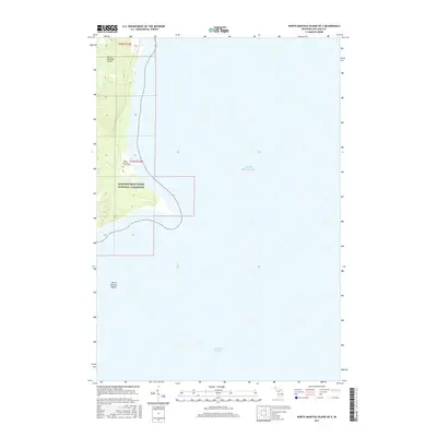
2017 Map of North Manitou Island OE E
USGS Topo · Published 2017About this map
North Manitou Island rises from the eastern waters of Lake Michigan, defined by the protective boundaries of the Sleeping Bear Dunes National Lakeshore. This portion of the island showcases the southeastern shoreline where the land meets the Manitou Passage, a historically significant maritime corridor. The map provides a quiet record of human presence on this isolated landscape, most notably the North Manitou Island Cem positioned inland from the eastern coast. The coastal shelf extends into the lake toward the North Manitou Shoals, illustrating the submerged topography that has long challenged navigators in the Leelanau archipelago. The survey reflects a modern era of conservation where former township lands and private holdings are managed as a national wilderness area, preserving the island's terrain from further development.
Find a feature on this map
8 named features on this map. Tap any name to fly to it.
Don’t see what you’re looking for? This feature index may not catch every label — zoom into the map to look around manually.
Map Details
Editions of this 2017 North Manitou Island OE E Map
This is the sole edition of this map. No revisions or reprints were ever made.
Other maps of this area

1954 · Traverse City
USGS Topo · 1:250,000

1954 · Escanaba
USGS Topo · 1:250,000

1954 · Manitowoc
USGS Topo · 1:250,000

1955 · Cheboygan
USGS Topo · 1:250,000

1956 · North Manitou
USGS Topo · 1:62,500

1957 · Escanaba
USGS Topo · 1:250,000

1957 · Empire
USGS Topo · 1:62,500

1957 · Maple City
USGS Topo · 1:62,500

1958 · Escanaba
USGS Topo · 1:250,000

1958 · Cheboygan
USGS Topo · 1:250,000