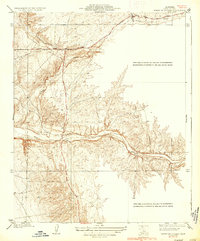
1936 Map of North of Oildale
USGS Topo · Published 1936About this map
Famoso Woody Road cuts through the transition between the San Joaquin Valley floor and the Sierra foothills in this 1930s Kern County landscape. The map centers on the drainage of Poso Creek, which winds through the central portion of the quadrangle, joined by Little Poso Creek to the north. These waterways were critical to the development of the region's ranching and early petroleum operations, as evidenced by the mention of Wells along the creek bed. While much of the terrain is defined by complex contouring and seasonal watercourses, the presence of a prominent Transmission Line running north-to-south reflects the growing industrial infrastructure of the mid-20th century. Surveyed by L.O. Newsome, this sheet provides a high-resolution view of the rural territory north of the primary Oildale developments, capturing the area before modern expansion altered the original ranch roads.
Find a feature on this map
6 named features on this map. Tap any name to fly to it.
Don’t see what you’re looking for? This feature index may not catch every label — zoom into the map to look around manually.
Map Details
Editions of this 1936 North of Oildale Map
3 editions found
Other maps of this area

1906 · Bakersfield
USGS Topo · 1:62,500

1910 · Buena Vista Lake
USGS Topo · 1:125,000

1912 · Buena Vista Lake
USGS Topo · 1:125,000

1914 · Caliente
USGS Topo · 1:125,000

1927 · McFarland
USGS Topo · 1:31,680

1930 · McFarland
USGS Topo · 1:31,680

1930 · Famoso
USGS Topo · 1:31,680

1930 · Rosedale
USGS Topo · 1:31,680

1930 · Oildale
USGS Topo · 1:31,680

1931 · Deepwell Ranch
USGS Topo · 1:31,680