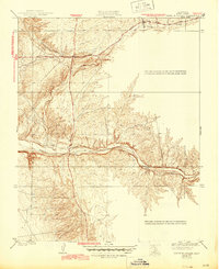
1936 Map of North of Oildale
USGS Topo · Published 1944About this map
Poso Creek and Little Poso Creek carve through the foothills of the southern San Joaquin Valley in this 1930s survey. The landscape is defined by the sharp, dendritic drainage patterns characteristic of the Kern County terrain, showing the relationship between natural watercourses and early infrastructure. The presence of a Transmission Line and a prominent Well indicate the early industrial and utility footprints in an area primarily used for grazing or petroleum exploration during this era. Transportation is anchored by the Famoso Woody Road, which served as a vital connector between the agricultural valley floor and the interior foothills, following the natural contours of the land. This map, surveyed by L.O. Newsome, provides a technical view of the topographic shifts and water management features essential to the region's development before post-war expansion.
Find a feature on this map
5 named features on this map. Tap any name to fly to it.
Don’t see what you’re looking for? This feature index may not catch every label — zoom into the map to look around manually.
Map Details
Editions of this 1936 North of Oildale Map
3 editions found
Other maps of this area

1906 · Bakersfield
USGS Topo · 1:62,500

1910 · Buena Vista Lake
USGS Topo · 1:125,000

1912 · Buena Vista Lake
USGS Topo · 1:125,000

1914 · Caliente
USGS Topo · 1:125,000

1927 · McFarland
USGS Topo · 1:31,680

1930 · McFarland
USGS Topo · 1:31,680

1930 · Famoso
USGS Topo · 1:31,680

1930 · Rosedale
USGS Topo · 1:31,680

1930 · Oildale
USGS Topo · 1:31,680

1931 · Deepwell Ranch
USGS Topo · 1:31,680