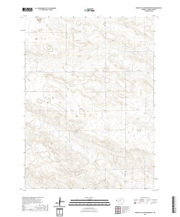
2021 Map of North of Oliver Reservoir
USGS Topo · Published 2021About this map
Kimball County's high plains are defined by a rhythmic, mile-square grid of section roads and range lines in this 2021 study. The landscape north of Oliver Reservoir reveals a sparse, rural infrastructure where the Public Land Survey System directly dictates the path of local travel. Major thoroughfares like Co Rd 52 and Co Rd 44 cut straight lines across the undulating terrain, which spans the townships of t16n r57w, t16n r56w, t15n r57w, and t15n r56w. This survey is a clear record of the modern Nebraska agricultural landscape, illustrating how property boundaries and drainage patterns interact in an area of minimal settlement and maximum spatial efficiency.
Find a feature on this map
16 named features on this map. Tap any name to fly to it.
Don’t see what you’re looking for? This feature index may not catch every label — zoom into the map to look around manually.
Map Details
Editions of this 2021 North of Oliver Reservoir Map
This is the sole edition of this map. No revisions or reprints were ever made.
Other maps of this area

1954 · Scottsbluff
USGS Topo · 1:250,000

1958 · Scottsbluff
USGS Topo · 1:250,000

1972 · Bushnell
USGS Topo · 1:24,000

1972 · Kimball
USGS Topo · 1:24,000

1972 · Oliver Reservoir
USGS Topo · 1:24,000

1973 · Kimball 2 NE
USGS Topo · 1:24,000

1973 · Kimball 2 SE
USGS Topo · 1:24,000
1973 · Kimball 2 SW
USGS Topo · 1:24,000
1973 · Kimball 2 NW
USGS Topo · 1:24,000

1973 · Kimball 1 NW
USGS Topo · 1:24,000