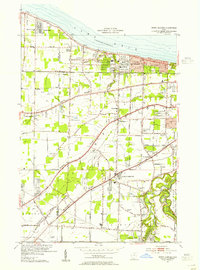
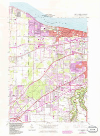
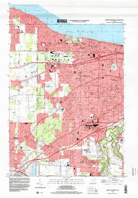
2023 Map of North Olmsted
USGS Topo · Published 2023About this map
Lake Erie defines the northern reaches of this suburban landscape, where the lakeside communities of Avon Lake and Bay Village transition into the densely settled residential grids of Westlake and North Olmsted. The terrain is shaped by distinct geological remnants, notably the parallel elevations of Butternut Ridge and Chestnut Ridge that run southwest to northeast, following the ancient glacial shorelines of the lake. These ridges serve as historical corridors for major thoroughfares like Lorain Rd and Detroit Rd, which historically facilitated movement between the growing outskirts of Cleveland and the rural townships to the west.
Find a feature on this map
42 named features on this map. Tap any name to fly to it.
Don’t see what you’re looking for? This feature index may not catch every label — zoom into the map to look around manually.
Map Details
Editions of this 2023 North Olmsted Map
This is the sole edition of this map. No revisions or reprints were ever made.
Historical Maps of Olmsted Township Through Time
4 maps found