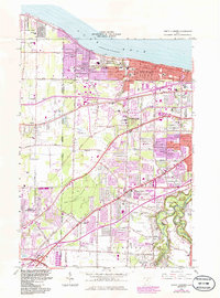
1963 Map of North Olmsted
USGS Topo · Published 1985About this map
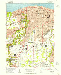
Lake Erie defines the northern edge of this suburban landscape, where the lakefront communities of Avon Lake and Bay Village meet the inland expansion of North Olmsted and Westlake. The terrain is marked by prominent geological features like Butternut Ridge and Center Ridge, which historically dictated the path of early roads and settlement patterns. Large protected areas such as the Huntington Reservation and Bradley Woods Reservation provide a green buffer against the rapid residential development indicated by the purple-tinted urban extensions. Local history is anchored by several long-standing institutions, including Bay View Hospital and numerous neighborhood schools like Dover Sch and Westerly Sch. The transition from a rail-dependent economy to an automobile-focused one is evident in the presence of the Norfolk and Western and Conrail lines alongside a developing network of arterial roads like Detroit Road and Lorain Road.
Find a feature on this map
87 named features on this map. Tap any name to fly to it.
Don’t see what you’re looking for? This feature index may not catch every label — zoom into the map to look around manually.
Map Details
Editions of this 1963 North Olmsted Map
4 editions found
Other maps of this area

1901 · Oberlin
USGS Topo · 1:62,500

1902 · Berea
USGS Topo · 1:62,500

1903 · Oberlin
USGS Topo · 1:62,500

1904 · Berea
USGS Topo · 1:62,500

1950 · Cleveland
USGS Topo · 1:250,000

1953 · West View
USGS Topo · 1:24,000

1953 · Berea
USGS Topo · 1:24,000

1953 · Grafton
USGS Topo · 1:24,000

1953 · Avon
USGS Topo · 1:24,000
1953 · Lakewood
USGS Topo · 1:24,000