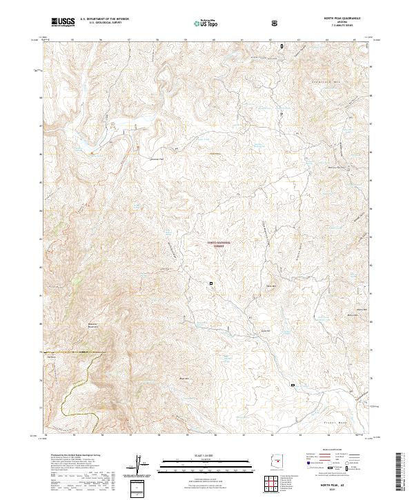
2021 Map of North Peak
USGS Topo · Published 2021About this map
The Tonto National Forest defines this high-elevation landscape, where the border of Yavapai and Gila counties cuts through the prominent Mazatzal Mountains. At the heart of the area stands North Peak, a focal point for a network of paths including the North Peak Trl and the Arizona National Scenic Trl. The terrain is deeply incised by drainages such as Pole Hollow Canyon and Table Mountain Canyon, which lead toward the E Verde River in the north. This 2021 survey illustrates a wilderness shaped by water sources and cattle ranching infrastructure. Numerous improved tanks, such as Snowstorm Tank and Zulu Tank, are scattered across the flats and gulches, while named springs like Larsen Spring and House Place Spring suggest reliable water points in an otherwise arid and demanding environment.
Find a feature on this map
76 named features on this map. Tap any name to fly to it.
Don’t see what you’re looking for? This feature index may not catch every label — zoom into the map to look around manually.
Map Details
Editions of this 2021 North Peak Map
This is the sole edition of this map. No revisions or reprints were ever made.
Other maps of this area

1887 · Verde
USGS Topo · 1:250,000

1892 · Verde
USGS Topo · 1:250,000

1929 · Turret Peak
USGS Topo · 1:125,000

1933 · Turret Peak
USGS Topo · 1:125,000

1934 · Pine
USGS Topo · 1:62,500

1936 · Payson
USGS Topo · 1:48,000

1940 · Pine
USGS Topo · 1:62,500

1942 · Payson
USGS Topo · 1:62,500

1952 · Pine
USGS Topo · 1:62,500

1954 · Holbrook
USGS Topo · 1:250,000