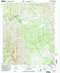
2004 Map of North Peak
USGS Topo · Published 2007About this map
Mazatzal Wilderness and the Tonto National Forest dominate this landscape, which marks the boundary between Gila and Yavapai counties. The terrain is defined by the high elevations of the Mazatzal Mountains, culminating at North Peak, where numerous canyons and gulches drain toward the Verde River and East Verde River. This era shows a landscape where remote ranching operations like the Doll Baby Ranch and Headquarters Well coexist with a legacy of mineral exploration.
Find a feature on this map
94 named features on this map. Tap any name to fly to it.
Don’t see what you’re looking for? This feature index may not catch every label — zoom into the map to look around manually.
Map Details
Editions of this 2004 North Peak Map
This is the sole edition of this map. No revisions or reprints were ever made.
Other maps of this area

1887 · Verde
USGS Topo · 1:250,000

1892 · Verde
USGS Topo · 1:250,000

1929 · Turret Peak
USGS Topo · 1:125,000

1933 · Turret Peak
USGS Topo · 1:125,000

1934 · Pine
USGS Topo · 1:62,500

1936 · Payson
USGS Topo · 1:48,000

1940 · Pine
USGS Topo · 1:62,500

1942 · Payson
USGS Topo · 1:62,500

1952 · Pine
USGS Topo · 1:62,500

1954 · Holbrook
USGS Topo · 1:250,000