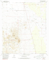
1965 Map of North PeAk
USGS Topo · Published 1986About this map
The Hermanas Mountains dominate this southwestern landscape, rising sharply above the desert floor with prominent heights like North Peak, Middle Peak, and South Peak. This mid-century survey records a sparsely populated ranching and mining environment in Luna County, characterized by the remote Inmon Ranch and San Juan Ranch. Prospectors and historians will find evidence of the area's mineral interests at the Lindy Ann Mine and a location marked simply as Chloride. The infrastructure of the era is defined by the vital network of water sources, including East Windmill, High Windmill, and Sturley Windmill, which sustained livestock across the arid stretches of the Greasewood Hills. Traceable jeep trails snake through Burns Draw and Canyon, connecting isolated points like Lonesome Cabin to the broader desert floor of Waterloo and Seventysix.
Find a feature on this map
30 named features on this map. Tap any name to fly to it.
Don’t see what you’re looking for? This feature index may not catch every label — zoom into the map to look around manually.
Map Details
Editions of this 1965 North PeAk Map
2 editions found
Other maps of this area

1899 · Deming
USGS Topo · 1:125,000

1915 · Deming
USGS Topo · 1:125,000

1917 · Hermanas
USGS Topo · 1:62,500

1917 · Columbus
USGS Topo · 1:62,500

1918 · Columbus
USGS Topo · 1:62,500

1918 · Hermanas
USGS Topo · 1:62,500

1920 · Columbus
USGS Topo · 1:62,500

1943 · Hermanas
USGS Topo · 1:62,500

1953 · El Paso
USGS Topo · 1:250,000

1955 · Las Cruces
USGS Topo · 1:250,000