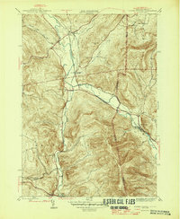
1946 Map of North Pownal
USGS Topo · Published 1946About this map
The Taconic Mountains dominate the landscape across the border of New York and Vermont, where the Hoosic River carves a path through steep hollows and narrow valleys. This mid-century survey reveals a rural economy centered on the river and the intersecting lines of the Rutland and Boston and Maine railroads. The map records several small rail-oriented settlements, including Hoosick, Petersburg Junction, and North Pownal. Local industry is evidenced by a Talc Mine tucked into the southern hills near Lincoln Hollow. Scattered one-room schoolhouses like School No 11 and School No 8 mark the residential centers of these small farming communities. The terrain is deeply textured, from the heights of Bald Mtn and White Rock down into the ancestral burials at Gardner Cem, providing a detailed look at the region's topography before modern development.
Find a feature on this map
33 named features on this map. Tap any name to fly to it.
Don’t see what you’re looking for? This feature index may not catch every label — zoom into the map to look around manually.
Map Details
Editions of this 1946 North Pownal Map
2 editions found
Other maps of this area

1886 · Greylock
USGS Topo · 1:62,500

1888 · Berlin
USGS Topo · 1:62,500

1890 · Berlin
USGS Topo · 1:62,500

1891 · Greylock
USGS Topo · 1:62,500

1893 · Greylock
USGS Topo · 1:62,500

1894 · Berlin
USGS Topo · 1:62,500

1897 · Hoosick
USGS Topo · 1:62,500

1898 · Berlin
USGS Topo · 1:62,500

1898 · Bennington
USGS Topo · 1:62,500

1898 · Greylock
USGS Topo · 1:62,500