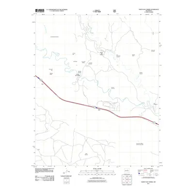
2011 Map of North San Ysidro
USGS Topo · Published 2011About this map
The Pecos River carves a winding path through this San Miguel County landscape, creating a geographic divide between the settlements of North San Ysidro and South San Ysidro. The area is characterized by a complex network of high mesas and deep drainages, including Gusano Mesa and the expansive Valle Grande to the south. Transportation in the early 21st century remains anchored to the corridor near Ilfeld, where local roads like San Jose Rd and County Rd B42A provide access to the river valley.
Find a feature on this map
32 named features on this map. Tap any name to fly to it.
Don’t see what you’re looking for? This feature index may not catch every label — zoom into the map to look around manually.
Map Details
Editions of this 2011 North San Ysidro Map
This is the sole edition of this map. No revisions or reprints were ever made.
Other maps of this area

1889 · Las Vegas
USGS Topo · 1:125,000

1889 · Santa Fe
USGS Topo · 1:125,000

1890 · Bernal
USGS Topo · 1:125,000

1891 · Bernal
USGS Topo · 1:125,000

1891 · Las Vegas
USGS Topo · 1:125,000

1893 · Las Vegas
USGS Topo · 1:125,000

1894 · Santa Fe
USGS Topo · 1:125,000

1894 · Bernal
USGS Topo · 1:125,000

1894 · Lamy
USGS Topo · 1:125,000

1954 · Santa Fe
USGS Topo · 1:250,000