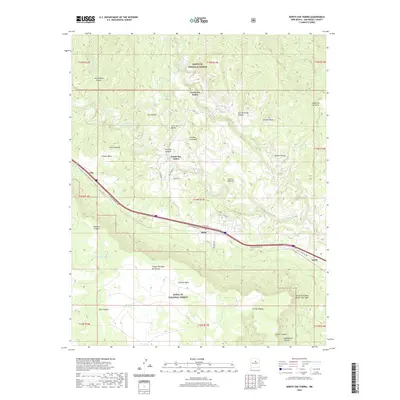
2020 Map of North San Ysidro
USGS Topo · Published 2020About this map
The Pecos River carves a winding path through this corner of San Miguel County, dictating the placement of settlements and transit corridors against the dramatic rise of Glorieta Mesa. Small communities like North San Ysidro and South San Ysidro are situated along the valley floor, while Ilfeld sits at a strategic transit point near Ilfeld Pass. The landscape is a complex network of canyons and mesas, including the prominent Gusano Mesa and the expansive Santa Fe National Forest that dominates the northern and southern reaches of the sheet.
Find a feature on this map
51 named features on this map. Tap any name to fly to it.
Don’t see what you’re looking for? This feature index may not catch every label — zoom into the map to look around manually.
Map Details
Editions of this 2020 North San Ysidro Map
This is the sole edition of this map. No revisions or reprints were ever made.
Other maps of this area

1889 · Las Vegas
USGS Topo · 1:125,000

1889 · Santa Fe
USGS Topo · 1:125,000

1890 · Bernal
USGS Topo · 1:125,000

1891 · Bernal
USGS Topo · 1:125,000

1891 · Las Vegas
USGS Topo · 1:125,000

1893 · Las Vegas
USGS Topo · 1:125,000

1894 · Santa Fe
USGS Topo · 1:125,000

1894 · Bernal
USGS Topo · 1:125,000

1894 · Lamy
USGS Topo · 1:125,000

1954 · Santa Fe
USGS Topo · 1:250,000