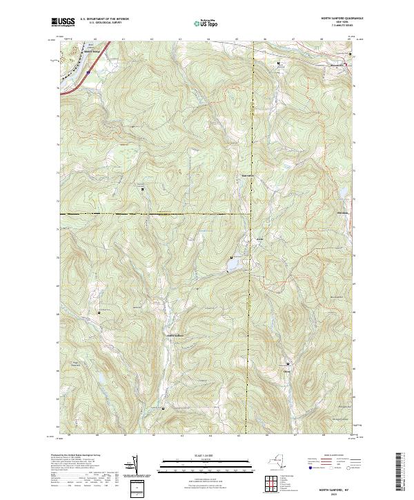
2023 Map of North Sanford
USGS Topo · Published 2023About this map
North Sanford sits at the heart of a high-elevation terrain where the borders of Broome, Chenango, and Delaware counties meet. This 2023 edition highlights a landscape defined by its network of upland streams like Oquaga Creek and Gold Spring Creek, which carve through the high ridges of Burnside Hill and Michigan Hill. The area maintains a dispersed rural character, with small settlements such as Arctic and China connected by winding roads that often follow the natural contours of the land.
Find a feature on this map
82 named features on this map. Tap any name to fly to it.
Don’t see what you’re looking for? This feature index may not catch every label — zoom into the map to look around manually.
Map Details
Editions of this 2023 North Sanford Map
This is the sole edition of this map. No revisions or reprints were ever made.
Other maps of this area

1902 · Coventry
USGS Topo · 1:62,500

1904 · Oxford
USGS Topo · 1:62,500

1905 · Nineveh
USGS Topo · 1:62,500

1915 · Unadilla
USGS Topo · 1:62,500

1918 · Unadilla
USGS Topo · 1:62,500

1924 · Deposit
USGS Topo · 1:62,500

1926 · Deposit
USGS Topo · 1:62,500

1943 · Sidney
USGS Topo · 1:24,000
1943 · Unadilla
USGS Topo · 1:24,000

1944 · Deposit
USGS Topo · 1:62,500