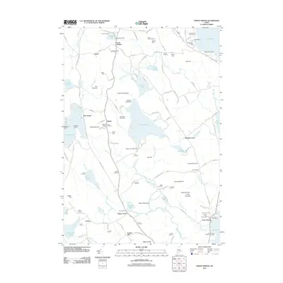
2011 Map of North Sebago
USGS Topo · Published 2011About this map
Peabody Pond and the Northwest River corridor dominate this portion of the Cumberland County highlands, where a network of family-named cemeteries preserves the region's genealogical history. Clusters of local heritage are evident at Sebago Center and South Bridgton, surrounded by namesake peaks like Bald Pate Mountain and Mariner Mountain. The infrastructure of the local timber and water economy is visible through features such as the Peabody Lake Mill Dam and the path of the Old Narrow Gauge Rd, which hints at historical transport patterns through the wooded terrain. Recreational camps and campgrounds, including Camp Pondicherry and Camp Winaco, are scattered near the shorelines of Hancock Pond and Adams Pond, reflecting the area's long-standing character as a destination for summer residency and outdoor activity.
Find a feature on this map
143 named features on this map. Tap any name to fly to it.
Don’t see what you’re looking for? This feature index may not catch every label — zoom into the map to look around manually.
Map Details
Editions of this 2011 North Sebago Map
This is the sole edition of this map. No revisions or reprints were ever made.
Other maps of this area

1896 · Norway
USGS Topo · 1:62,500

1896 · Sebago
USGS Topo · 1:62,500

1909 · Fryeburg
USGS Topo · 1:62,500

1910 · Kezar Falls
USGS Topo · 1:48,000

1911 · Fryeburg
USGS Topo · 1:62,500

1911 · Kezar Falls
USGS Topo · 1:62,500

1941 · Fryeburg
USGS Topo · 1:62,500

1942 · Sebago Lake
USGS Topo · 1:62,500

1943 · Sebago Lake
USGS Topo · 1:62,500

1946 · Norway
USGS Topo · 1:62,500