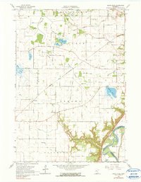
1965 Map of North Star
USGS Topo · Published 1990About this map
North Star and the surrounding townships of Lake Prairie, Traverse, and Oshawa define this agricultural landscape in Nicollet County during the mid-1960s. The map captures a transition in transportation, showing the Chicago and North Western railway cutting through the center of the sheet alongside an Old Railroad Grade and the historic path of the Old Fort Road. To the south, the terrain drops significantly into the deeply etched valley of Sevenmile Creek, which leads toward the Minnesota River at the border with Le Sueur County.
Find a feature on this map
35 named features on this map. Tap any name to fly to it.
Don’t see what you’re looking for? This feature index may not catch every label — zoom into the map to look around manually.
Map Details
Editions of this 1965 North Star Map
2 editions found

Other maps of this area

1950 · Mankato East
USGS Topo · 1:62,500

1951 · Mankato East
USGS Topo · 1:62,500

1951 · Mankato West
USGS Topo · 1:62,500

1953 · Saint Paul
USGS Topo · 1:250,000

1953 · New Ulm
USGS Topo · 1:250,000

1957 · New Ulm
USGS Topo · 1:250,000

1958 · New Ulm
USGS Topo · 1:250,000

1959 · Saint Paul
USGS Topo · 1:250,000

1965 · Norseland
USGS Topo · 1:24,000

1965 · New Sweden
USGS Topo · 1:24,000