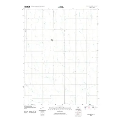
2010 Map of Northbranch
USGS Topo · Published 2010About this map
Burr Oak anchors the southern portion of this Jewell County landscape, a region defined by its intricate network of prairie streams and agricultural grid. The settlement pattern is sparse, typical of the north-central Kansas plains, with the small community of Northbranch situated in the northwest and Wesley Center positioned centrally. These small hubs were established to serve the surrounding farmsteads, many of which are linked by the rigid section-line roads that dominate the topography.
Find a feature on this map
13 named features on this map. Tap any name to fly to it.
Don’t see what you’re looking for? This feature index may not catch every label — zoom into the map to look around manually.
Map Details
Editions of this 2010 Northbranch Map
This is the sole edition of this map. No revisions or reprints were ever made.
Other maps of this area

1894 · Mankato
USGS Topo · 1:125,000

1898 · Superior
USGS Topo · 1:125,000

1955 · Grand Island
USGS Topo · 1:250,000

1955 · Beloit
USGS Topo · 1:250,000

1957 · Grand Island
USGS Topo · 1:250,000

1958 · Grand Island
USGS Topo · 1:250,000

1959 · Beloit
USGS Topo · 1:250,000
1968 · Burr Oak NW
USGS Topo · 1:24,000

1968 · Burr Oak
USGS Topo · 1:24,000

1969 · Mankato
USGS Topo · 1:24,000