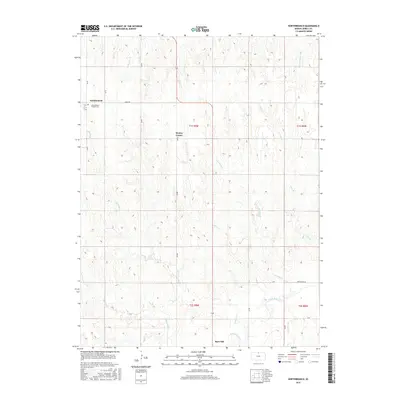
2016 Map of Northbranch
USGS Topo · Published 2016About this map
Northbranch and the nearby North Branch Friends Cem anchor the northwestern corner of this Kansas landscape, where the headwaters of numerous small creeks carve through the plains. The terrain is defined by a dendritic drainage pattern flowing generally southward toward the White Rock Cr valley. To the south, the settlement of Burr Oak sits near the confluence of Burr Oak Cr and White Rock Cr, serving as a focal point for the surrounding agricultural sections.
Find a feature on this map
28 named features on this map. Tap any name to fly to it.
Don’t see what you’re looking for? This feature index may not catch every label — zoom into the map to look around manually.
Map Details
Editions of this 2016 Northbranch Map
This is the sole edition of this map. No revisions or reprints were ever made.
Other maps of this area

1894 · Mankato
USGS Topo · 1:125,000

1898 · Superior
USGS Topo · 1:125,000

1955 · Grand Island
USGS Topo · 1:250,000

1955 · Beloit
USGS Topo · 1:250,000

1957 · Grand Island
USGS Topo · 1:250,000

1958 · Grand Island
USGS Topo · 1:250,000

1959 · Beloit
USGS Topo · 1:250,000
1968 · Burr Oak NW
USGS Topo · 1:24,000

1968 · Burr Oak
USGS Topo · 1:24,000

1969 · Mankato
USGS Topo · 1:24,000