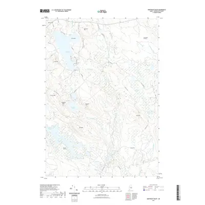
2021 Map of Northeast Bluff
USGS Topo · Published 2021About this map
Pleasant River Lake and its intricate shoreline dominate the northwestern corner of this Washington County landscape, where the Pleasant River winds southward through a mosaic of wetlands and ridges. The topography is defined by prominent elevations such as Northeast Bluff, Southwest Bluff, and Beech Hill, interspersed with expansive peatlands like Allen Heath and Beech-Hill Heath. This interior Maine region is characterized by a high density of small water bodies and drainage systems, including Flynn Pond, Oak Pond, and Otter Pond, often connected by seasonal brooks like Ingersoll Br and Colonel Brook. The network of logging and access roads, such as Beech Hill Rd and Hatchery Rd, reflects a landscape managed for natural resources. To the south, the Bog Brook Flowage and Dorman Island illustrate the complex hydrography of the Downeast interior, where land and water are constantly intertwined.
Find a feature on this map
63 named features on this map. Tap any name to fly to it.
Don’t see what you’re looking for? This feature index may not catch every label — zoom into the map to look around manually.
Map Details
Editions of this 2021 Northeast Bluff Map
This is the sole edition of this map. No revisions or reprints were ever made.
Other maps of this area

1902 · Cherryfield
USGS Topo · 1:62,500

1904 · Cherryfield
USGS Topo · 1:62,500

1929 · Lead Mountain
USGS Topo · 1:48,000

1930 · Tunk Lake
USGS Topo · 1:48,000

1932 · Tunk Lake
USGS Topo · 1:62,500

1932 · Lead Mountain
USGS Topo · 1:62,500

1941 · Tug Mountain
USGS Topo · 1:62,500

1942 · Cherryfield
USGS Topo · 1:62,500

1942 · Tunk Lake
USGS Topo · 1:62,500

1943 · Tug Mountain
USGS Topo · 1:62,500