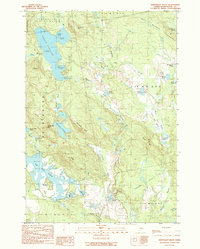
1990 Map of Northeast Bluff
USGS Topo · Published 1990About this map
Pleasant River Lake dominates the northern reaches of this Washington County landscape, where the waters of the Pleasant River flow through a complex system of heaths and ponds. This interior region of eastern Maine is defined by its topographic extremes, from the heights of Pleasant Mountain and Northeast Bluff to the expansive wetlands of Bridgham Swamp and Allen Heath. The map details a largely uninhabited territory organized by the Bingham Purchase boundary lines, including Devereaux (T 29 M D B P P) and Deblois. Numerous smaller water bodies like Southwest Pond, Merrit Pond, and Pretty Pond dot the terrain, while Dorman Island sits within the lower flowage. The lack of major settlements highlights the area's history as a managed wilderness of ridges and timberlands, with Hall Ridge and Spruce Ridge providing clear landmarks for navigators and land managers alike.
Find a feature on this map
48 named features on this map. Tap any name to fly to it.
Don’t see what you’re looking for? This feature index may not catch every label — zoom into the map to look around manually.
Map Details
Editions of this 1990 Northeast Bluff Map
This is the sole edition of this map. No revisions or reprints were ever made.
Other maps of this area

1902 · Cherryfield
USGS Topo · 1:62,500

1904 · Cherryfield
USGS Topo · 1:62,500

1929 · Lead Mountain
USGS Topo · 1:48,000

1930 · Tunk Lake
USGS Topo · 1:48,000

1932 · Tunk Lake
USGS Topo · 1:62,500

1932 · Lead Mountain
USGS Topo · 1:62,500

1941 · Tug Mountain
USGS Topo · 1:62,500

1942 · Cherryfield
USGS Topo · 1:62,500

1942 · Tunk Lake
USGS Topo · 1:62,500

1943 · Tug Mountain
USGS Topo · 1:62,500