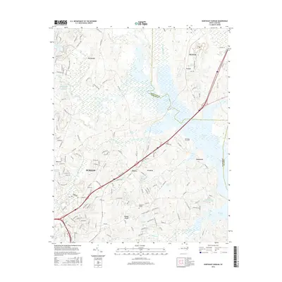
2016 Map of Northeast Durham
USGS Topo · Published 2016About this map
Fairntosh and the northern reaches of Durham characterize this landscape, where suburban growth meets the protected watersheds of the Little River and Eno River. The 2016 survey highlights a complex network of reservoirs and smaller lakes, including Brinkley Lake and the Infinity Rd Raw Water Reservoir, which define the local drainage patterns near the Granville and Durham County line. Small communities and established neighborhoods such as Gorman, Redwood, and Cozart are shown connected by a dense grid of residential streets and arterial roads like Stagville Rd. A notable aviation landmark, Lake Ridge Aero Park, sits nestled between Newcombs Lake and the surrounding wetlands, while Oak Grove Memorial Gardens serves as a significant local landmark for genealogists. The terrain is further etched by numerous tributaries including Ellerbe Creek and Chunky Pipe Cr, illustrating the area's transition from urban core to rural conservation lands.
Find a feature on this map
147 named features on this map. Tap any name to fly to it.
Don’t see what you’re looking for? This feature index may not catch every label — zoom into the map to look around manually.
Map Details
Editions of this 2016 Northeast Durham Map
This is the sole edition of this map. No revisions or reprints were ever made.
Other maps of this area

1943 · Durham South
USGS Topo · 1:62,500

1943 · Raleigh
USGS Topo · 1:62,500

1943 · Creedmoor
USGS Topo · 1:62,500

1944 · Creedmoor
USGS Topo · 1:62,500

1951 · Raleigh
USGS Topo · 1:62,500

1951 · Durham South
USGS Topo · 1:62,500

1951 · Durham North
USGS Topo · 1:62,500

1953 · Raleigh
USGS Topo · 1:250,000

1953 · Greensboro
USGS Topo · 1:250,000

1954 · Greensboro
USGS Topo · 1:250,000