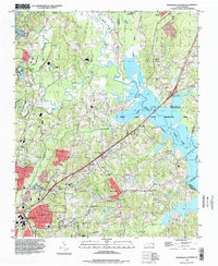
1993 Map of Northeast Durham
USGS Topo · Published 1998About this map
The Little River, Flat River, and Eno River converge in this landscape, creating the headwaters of the Neuse River and the expansive Falls Lake. This environment is defined by the Falls Lake State Recreation Area, which encompasses much of the eastern terrain. To the west, the Durham Corp Bdy marks the urban expansion of Durham, where neighborhood development meets older rural landmarks.
Find a feature on this map
49 named features on this map. Tap any name to fly to it.
Don’t see what you’re looking for? This feature index may not catch every label — zoom into the map to look around manually.
Map Details
Editions of this 1993 Northeast Durham Map
This is the sole edition of this map. No revisions or reprints were ever made.
Other maps of this area

1943 · Durham South
USGS Topo · 1:62,500

1943 · Raleigh
USGS Topo · 1:62,500

1943 · Creedmoor
USGS Topo · 1:62,500

1944 · Creedmoor
USGS Topo · 1:62,500

1951 · Raleigh
USGS Topo · 1:62,500

1951 · Durham South
USGS Topo · 1:62,500

1951 · Durham North
USGS Topo · 1:62,500

1953 · Raleigh
USGS Topo · 1:250,000

1953 · Greensboro
USGS Topo · 1:250,000

1954 · Greensboro
USGS Topo · 1:250,000