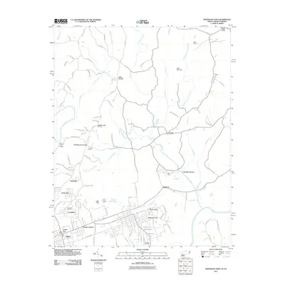
2011 Map of Northeast Eden
USGS Topo · Published 2011About this map
Eden and its expanding northern neighborhoods form the core of this landscape, where the Dan River meets the smaller tributaries that carve through the Virginia-North Carolina borderlands. Residential developments like Meadow Summit, Green Acres, and Creekridge illustrate the 21st-century footprint of the area, while older settlement patterns remain visible at Starlings Crossroads and Leaksville Junction. The terrain is defined by the flow of Cascade Creek and the Smith River, which is crossed by the Morgan Ford Bridge near the western edge.
Find a feature on this map
96 named features on this map. Tap any name to fly to it.
Don’t see what you’re looking for? This feature index may not catch every label — zoom into the map to look around manually.
Map Details
Editions of this 2011 Northeast Eden Map
This is the sole edition of this map. No revisions or reprints were ever made.
Other maps of this area

1924 · Martinsville
USGS Topo · 1:48,000

1924 · Draper
USGS Topo · 1:48,000

1926 · Martinsville
USGS Topo · 1:62,500

1926 · Draper
USGS Topo · 1:62,500

1927 · Martinsville
USGS Topo · 1:62,500

1944 · Martinsville
USGS Topo · 1:62,500

1944 · Draper
USGS Topo · 1:62,500

1953 · Greensboro
USGS Topo · 1:250,000

1954 · Greensboro
USGS Topo · 1:250,000

1962 · Greensboro
USGS Topo · 1:250,000