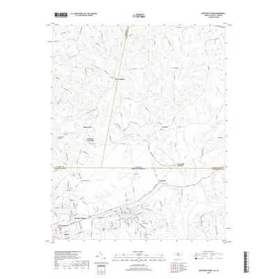
2019 Map of Northeast Eden
USGS Topo · Published 2019About this map
The Dan River and Smith River confluence defines the industrial and residential landscape of Eden, North Carolina, as it transitions northward across the state line into Henry and Pittsylvania Counties, Virginia. This 2019 survey captures the developed Central Area and residential clusters of Meadow Summit, set against a backdrop of historic rural crossroad communities. To the north, the terrain rises into the foothills of the Blue Ridge, marked by Stills Mtn and Boyd Mtn. Local history is preserved in several family and community burial grounds, including Starling Cem, Blue Creek Cem, and Dan View Cem. The map illustrates a complex network of colonial-era routes and modern connectors, such as Irisburg Rd and Cascade Rd, which link the larger manufacturing hub of Eden with outlying settlements like Starlings Crossroads and Aiken Summit. The prominence of Leaksville Junction serves as a reminder of the area's deep-rooted textile and rail heritage.
Find a feature on this map
139 named features on this map. Tap any name to fly to it.
Don’t see what you’re looking for? This feature index may not catch every label — zoom into the map to look around manually.
Map Details
Editions of this 2019 Northeast Eden Map
This is the sole edition of this map. No revisions or reprints were ever made.
Other maps of this area

1924 · Martinsville
USGS Topo · 1:48,000

1924 · Draper
USGS Topo · 1:48,000

1926 · Martinsville
USGS Topo · 1:62,500

1926 · Draper
USGS Topo · 1:62,500

1927 · Martinsville
USGS Topo · 1:62,500

1944 · Martinsville
USGS Topo · 1:62,500

1944 · Draper
USGS Topo · 1:62,500

1953 · Greensboro
USGS Topo · 1:250,000

1954 · Greensboro
USGS Topo · 1:250,000

1962 · Greensboro
USGS Topo · 1:250,000