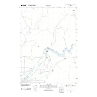
2010 Map of Northeast Emmett
USGS Topo · Published 2010About this map
The Payette River anchors this Idaho landscape, where the infrastructure of early 21st-century water management is on full display. The Black Canyon Dam creates a significant bottleneck in the river's path, feeding an intricate network of irrigation systems including the Black Canyon Canal, Farmers Cooperative Canal, and Last Chance Canal. These waterways underscore the region's agricultural dependency and engineering heritage, branching out through the valley near Emmett. Below the dam, the river widens to surround Fuller Island and Ross Island. The surrounding terrain is marked by steep features like Black Canyon, Shellrock Canyon, and Little Butte, which overlook a network of rural roads such as Frozen Dog Rd and Old Dam Rd. The small settlement of Plaza sits near the canal junctions, representing the intersection of human habitation and the managed flow of the Payette.
Find a feature on this map
40 named features on this map. Tap any name to fly to it.
Don’t see what you’re looking for? This feature index may not catch every label — zoom into the map to look around manually.
Map Details
Editions of this 2010 Northeast Emmett Map
This is the sole edition of this map. No revisions or reprints were ever made.
Other maps of this area

1892 · Boise
USGS Topo · 1:125,000

1894 · Squaw Creek
USGS Topo · 1:125,000

1897 · Boise
USGS Topo · 1:125,000

1897 · Weiser
USGS Topo · 1:125,000

1898 · Nampa
USGS Topo · 1:125,000

1953 · Montour
USGS Topo · 1:62,500

1955 · Baker
USGS Topo · 1:250,000

1955 · Boise
USGS Topo · 1:250,000

1958 · Boise
USGS Topo · 1:250,000

1959 · Baker
USGS Topo · 1:250,000