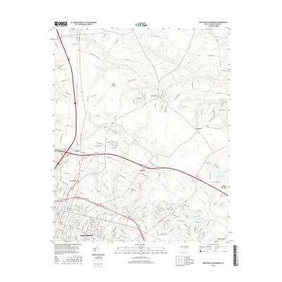
2016 Map of Northeast Goldsboro
USGS Topo · Published 2016About this map
Goldsboro serves as the primary urban hub on this 2016 survey, with its grid of streets such as Booker St and Atlantic Ave radiating outward toward the smaller outlying communities of Belfast, Patetown, and Saulston. This modern record of Wayne County shows the extensive infrastructure of the Wayne Executive Jetport and the Wayne Community Coll campus, reflecting the area's development as an educational and transportation center. The landscape is defined by the drainage patterns of The Slough, Moccasin Run, and Stoney Cr, which cut through the coastal plain and influence the placement of early settlements and family landmarks. Genealogists will find several burial grounds noted, including Pikesville Cem, Greenleaf Cem, and the Old Mill Cem near Wills Pond. The map also details more contemporary features like the Bear Cr W/S Lake Number Three, demonstrating how water management has evolved over time in this North Carolina corridor.
Find a feature on this map
200 named features on this map. Tap any name to fly to it.
Don’t see what you’re looking for? This feature index may not catch every label — zoom into the map to look around manually.
Map Details
Editions of this 2016 Northeast Goldsboro Map
This is the sole edition of this map. No revisions or reprints were ever made.
Other maps of this area

1902 · Kenly
USGS Topo · 1:62,500

1903 · Kenly
USGS Topo · 1:62,500

1904 · Wilson
USGS Topo · 1:62,500

1953 · Rocky Mount
USGS Topo · 1:250,000

1953 · Raleigh
USGS Topo · 1:250,000

1954 · Rocky Mount
USGS Topo · 1:250,000

1954 · Raleigh
USGS Topo · 1:250,000

1957 · Goldsboro
USGS Topo · 1:62,500

1974 · Northwest Goldsboro
USGS Topo · 1:24,000

1974 · Southwest Goldsboro
USGS Topo · 1:24,000