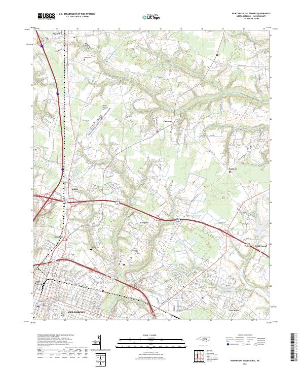
2022 Map of Northeast Goldsboro
USGS Topo · Published 2022About this map
The northern reaches of Goldsboro and its surrounding communities are mapped here, showing a landscape defined by the drainage patterns of Stoney Cr and several namesake branches. The terrain is crisscrossed by historic rural roads like Big Daddy's Rd and Patetown Rd, connecting established settlements such as Pikeville and Patetown. This era of the region’s development is marked by the presence of modern infrastructure, including the Wayne Executive Jetport and the campus of Wayne Community College. Along the eastern edge, the geography becomes notably more swampy near Hood Swamp and The Slough. Local history is preserved in the numerous burial grounds documented, including Pikeville Cem and Greenleaf Cem. The map provides a precise look at the transition from the urban grid of the county seat to the outlying hamlets like Saulston and New Hope.
Find a feature on this map
216 named features on this map. Tap any name to fly to it.
Don’t see what you’re looking for? This feature index may not catch every label — zoom into the map to look around manually.
Map Details
Editions of this 2022 Northeast Goldsboro Map
This is the sole edition of this map. No revisions or reprints were ever made.
Other maps of this area

1902 · Kenly
USGS Topo · 1:62,500

1903 · Kenly
USGS Topo · 1:62,500

1904 · Wilson
USGS Topo · 1:62,500

1953 · Rocky Mount
USGS Topo · 1:250,000

1953 · Raleigh
USGS Topo · 1:250,000

1954 · Rocky Mount
USGS Topo · 1:250,000

1954 · Raleigh
USGS Topo · 1:250,000

1957 · Goldsboro
USGS Topo · 1:62,500

1974 · Northwest Goldsboro
USGS Topo · 1:24,000

1974 · Southwest Goldsboro
USGS Topo · 1:24,000