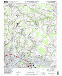
1998 Map of Northeast Goldsboro
USGS Topo · Published 2001About this map
Goldsboro expands northward along the Stoney Creek corridor in the late 1990s, revealing a landscape where traditional crossroads like Patetown and Saulston meet modern institutional development. The map details a significant concentration of public infrastructure, from the sprawling campus of Wayne Community College and the Wayne Co Mem Hospital to the Goldsboro-Wayne Municipal Airport. These modern centers contrast with the area's rural roots, evidenced by numerous small family and community burial sites like Pikeville Cem and Old Mill Cem.
Find a feature on this map
56 named features on this map. Tap any name to fly to it.
Don’t see what you’re looking for? This feature index may not catch every label — zoom into the map to look around manually.
Map Details
Editions of this 1998 Northeast Goldsboro Map
This is the sole edition of this map. No revisions or reprints were ever made.
Other maps of this area

1902 · Kenly
USGS Topo · 1:62,500

1903 · Kenly
USGS Topo · 1:62,500

1904 · Wilson
USGS Topo · 1:62,500

1953 · Rocky Mount
USGS Topo · 1:250,000

1953 · Raleigh
USGS Topo · 1:250,000

1954 · Rocky Mount
USGS Topo · 1:250,000

1954 · Raleigh
USGS Topo · 1:250,000

1957 · Goldsboro
USGS Topo · 1:62,500

1974 · Northwest Goldsboro
USGS Topo · 1:24,000

1974 · Southwest Goldsboro
USGS Topo · 1:24,000