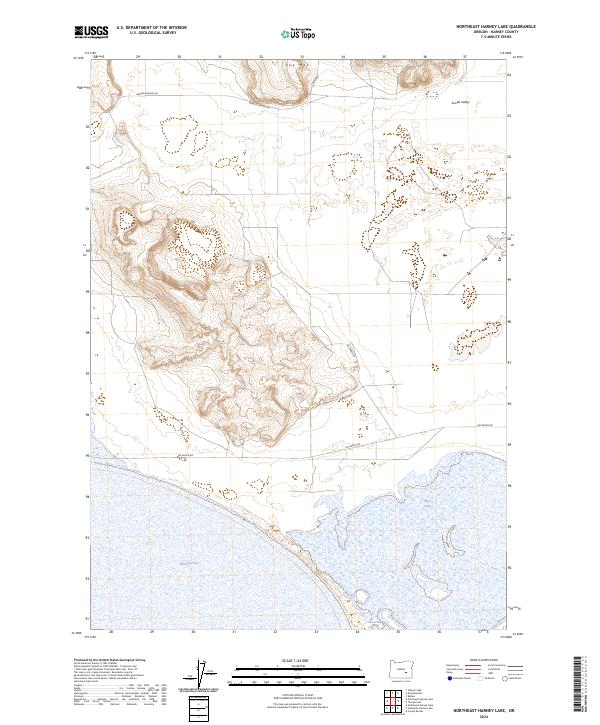
2024 Map of Northeast Harney Lake
USGS Topo · Published 2024About this map
Malheur National Wildlife Refuge anchors the southern portion of this landscape, encompassing the alkaline waters and seasonal wetlands of Harney Lake and Mud Lake. The terrain transitions from these low-lying basins toward the elevation of Dog Mtn in the north and the expansive Sunset Valley to the east. The map records a network of established desert routes including Oo Ranch Rd, Weaver Springs Rd, and Mccanna Rd, which traverse the high desert sagebrush and volcanic features. This 2024 survey documents the hydrography and public land boundaries during a modern era of conservation management. The grid of section lines across townships like t25s r30e and t26s r31e illustrates the systematic division of this Oregon backcountry, where ranching heritage and wildlife protection intersect near the shores of the lake.
Find a feature on this map
15 named features on this map. Tap any name to fly to it.
Don’t see what you’re looking for? This feature index may not catch every label — zoom into the map to look around manually.
Map Details
Editions of this 2024 Northeast Harney Lake Map
This is the sole edition of this map. No revisions or reprints were ever made.
Other maps of this area

1955 · Burns
USGS Topo · 1:250,000

1958 · Burns
USGS Topo · 1:250,000

1959 · Burns
USGS Topo · 1:250,000

1959 · Dog Mountain
USGS Topo · 1:62,500

1959 · Lawen
USGS Topo · 1:62,500

1967 · Coyote Buttes
USGS Topo · 1:24,000

1978 · Malheur Lake
USGS Topo · 1:100,000
1980 · Southwest Harney Lake
USGS Topo · 1:24,000
1980 · Southeast Harney Lake
USGS Topo · 1:24,000
1990 · The Narrows
USGS Topo · 1:24,000