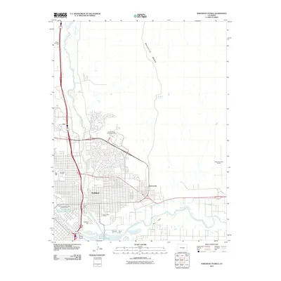
2010 Map of Northeast Pueblo
USGS Topo · Published 2010About this map
Pueblo anchors this landscape at the confluence of the Arkansas River and Fountain Creek, where urban expansion meets the high plains. The city’s northern and eastern reaches are defined by significant industrial and institutional infrastructure, including the campus of Colorado State University-Pueblo and the Pueblo Memorial Airport. Water management is central to the area's development, evidenced by the Greenville Ditch, Booth Canal, and the South Colorado Power Company Reservoir.
Find a feature on this map
21 named features on this map. Tap any name to fly to it.
Don’t see what you’re looking for? This feature index may not catch every label — zoom into the map to look around manually.
Map Details
Editions of this 2010 Northeast Pueblo Map
This is the sole edition of this map. No revisions or reprints were ever made.
Other maps of this area

1891 · Pueblo
USGS Topo · 1:125,000

1891 · Nepesta
USGS Topo · 1:125,000

1893 · Nepesta
USGS Topo · 1:125,000

1894 · Pueblo
USGS Topo · 1:125,000

1896 · Pueblo
USGS Topo · 1:125,000

1897 · Pueblo
USGS Topo · 1:125,000

1904 · Nepesta
USGS Topo · 1:125,000

1954 · Pueblo
USGS Topo · 1:250,000

1957 · Pueblo
USGS Topo · 1:250,000

1958 · Pueblo
USGS Topo · 1:250,000