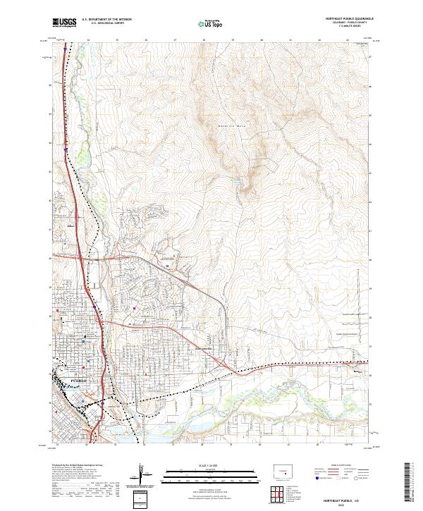
2022 Map of Northeast Pueblo
USGS Topo · Published 2022About this map
The Pueblo metropolitan area meets the high desert plateaus of southern Colorado in this modern topographical study. The urban grid is anchored by the Pueblo Judicial Building and the Colorado State University Pueblo campus, while industrial and logistical hubs like the Pueblo Memorial Airport and the community of Baxter dominate the eastern reaches. Historic preservation is evident at the Masonic Cem and B'Nai Jacob Cem, which sit near the steep slopes of Big Hill. The landscape is fundamentally defined by the management of water in an arid environment, seen in the convergence of the Arkansas River and Fountain Creek, as well as the intricate path of the Booth Canal. This network of waterways supports the lower-lying settlements like Fearnowville and Eden, while the massive landform of Baculite Mesa rises to the north, providing a stark geographic boundary to the city's suburban expansion.
Find a feature on this map
43 named features on this map. Tap any name to fly to it.
Don’t see what you’re looking for? This feature index may not catch every label — zoom into the map to look around manually.
Map Details
Editions of this 2022 Northeast Pueblo Map
This is the sole edition of this map. No revisions or reprints were ever made.
Other maps of this area

1891 · Pueblo
USGS Topo · 1:125,000

1891 · Nepesta
USGS Topo · 1:125,000

1893 · Nepesta
USGS Topo · 1:125,000

1894 · Pueblo
USGS Topo · 1:125,000

1896 · Pueblo
USGS Topo · 1:125,000

1897 · Pueblo
USGS Topo · 1:125,000

1904 · Nepesta
USGS Topo · 1:125,000

1954 · Pueblo
USGS Topo · 1:250,000

1957 · Pueblo
USGS Topo · 1:250,000

1958 · Pueblo
USGS Topo · 1:250,000