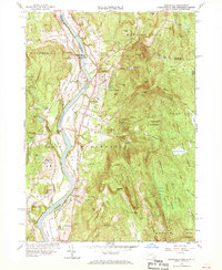
1961 Map of Northfield
USGS Topo · Published 1970About this map
The Connecticut River bisects this tristate border region, where Massachusetts, New Hampshire, and Vermont converge at the Hinsdale and Vernon lines. In the early 1960s, the valley floor near Northfield remains defined by agricultural expanses like Great Meadow and Beers Plain, while the upland terrain to the east is dominated by the steep slopes of Brush Mountain and Northfield State Forest. This landscape is fundamentally tied to the corridor of the Central Vermont RR and Boston and Maine RR, which connect the small village centers and agricultural stations. Educational institutions form a prominent part of the local identity, notably the Northfield School and Mount Hermon School. A network of cemeteries, including West Northfield Cem and St Marys Cem, provides a detailed record of the families who settled this fertile river valley and the rugged timberlands of Warwick State Forest.
Find a feature on this map
104 named features on this map. Tap any name to fly to it.
Don’t see what you’re looking for? This feature index may not catch every label — zoom into the map to look around manually.
Map Details
Editions of this 1961 Northfield Map
2 editions found
Other maps of this area

1887 · Warwick
USGS Topo · 1:62,500

1889 · Warwick
USGS Topo · 1:62,500

1890 · Greenfield
USGS Topo · 1:62,500

1891 · Brattleboro
USGS Topo · 1:62,500

1893 · Brattleboro
USGS Topo · 1:62,500

1894 · Greenfield
USGS Topo · 1:62,500

1894 · Warwick
USGS Topo · 1:62,500

1898 · Keene
USGS Topo · 1:62,500

1932 · Brattleboro
USGS Topo · 1:48,000

1932 · Warwick
USGS Topo · 1:48,000