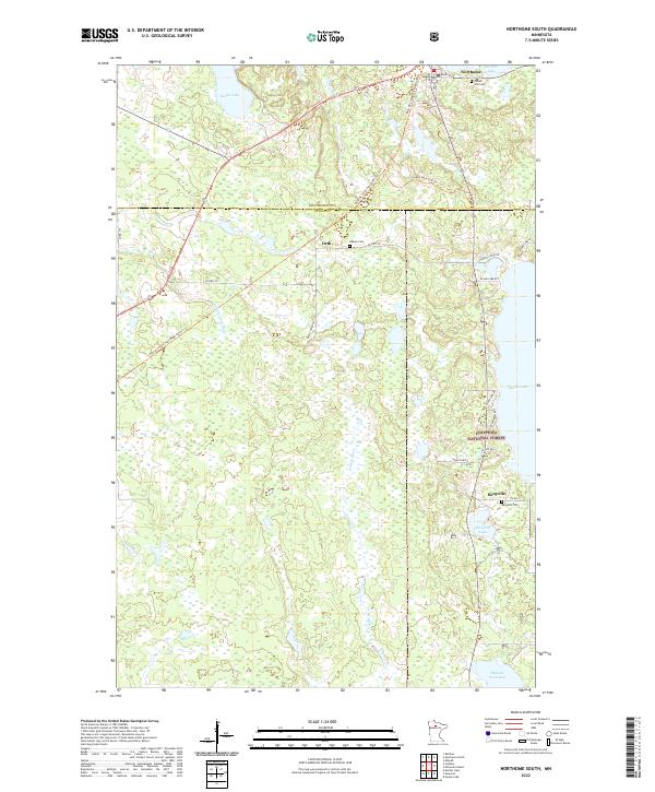
2022 Map of Northome South
USGS Topo · Published 2022About this map
Northome sits at the northern edge of this northern Minnesota landscape, where the border between Koochiching Co and Itasca Co divides the terrain. The map documents a sparsely populated region characterized by small clusters of settlement like Orth and Bergville, which are connected by a network of rural routes including Co Hwy 30 and Orth Tower Rd. The influence of the timber and recreation industries is evident through the inclusion of the Chippewa National Forest and the Blue Ox State Trail. Waterways such as the Popple River and N Cormorant River drain the lowlands between scattered bodies of water like Island Lake and Bergville Lake. Genealogists will find value in the specific locations of rural burial grounds, including Forest Hill Cem, Oakum Cem, and Bergville Cem.
Find a feature on this map
34 named features on this map. Tap any name to fly to it.
Don’t see what you’re looking for? This feature index may not catch every label — zoom into the map to look around manually.
Map Details
Editions of this 2022 Northome South Map
This is the sole edition of this map. No revisions or reprints were ever made.
Other maps of this area

1919 · Rosy
USGS Topo · 1:62,500

1919 · Gemmell
USGS Topo · 1:62,500

1919 · Max
USGS Topo · 1:62,500

1919 · Bridgie
USGS Topo · 1:62,500

1924 · Bridgie
USGS Topo · 1:62,500

1954 · Bemidji
USGS Topo · 1:250,000

1957 · Bemidji
USGS Topo · 1:250,000

1958 · Bemidji
USGS Topo · 1:250,000

1971 · Squaw Lake
USGS Topo · 1:24,000

1971 · Funkley
USGS Topo · 1:24,000