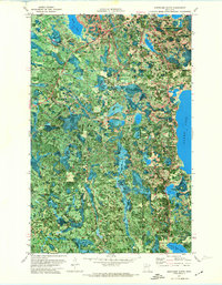
1971 Map of Northome South
USGS Topo · Published 1974About this map
Island Lake and its intricate eastern shoreline dominate this 1970s orthophotomap, showing the watery landscape of northern Minnesota where the Koochiching and Itasca county lines meet. The small settlements of Northome and Bergville serve as local hubs, connected by the Burlington Northern railroad and highways 71 and 1. This survey provides a distinct photographic look at the region's transition between managed timberlands and natural wetlands, with the Blackduck State Forest covering the southern reaches. Local landmarks like the Northome Lookout Tower and a Fish Hatchery near Bartlett Lake are clearly marked, alongside the Forest Hill and Oakum cemeteries. The density of small water bodies like Nesseth Lake and the winding Popple River illustrates the complex drainage patterns of the north woods, where the timber economy and outdoor resources like Moose Park intersect.
Find a feature on this map
26 named features on this map. Tap any name to fly to it.
Don’t see what you’re looking for? This feature index may not catch every label — zoom into the map to look around manually.
Map Details
Editions of this 1971 Northome South Map
This is the sole edition of this map. No revisions or reprints were ever made.
Other maps of this area

1919 · Rosy
USGS Topo · 1:62,500

1919 · Gemmell
USGS Topo · 1:62,500

1919 · Max
USGS Topo · 1:62,500

1919 · Bridgie
USGS Topo · 1:62,500

1924 · Bridgie
USGS Topo · 1:62,500

1954 · Bemidji
USGS Topo · 1:250,000

1957 · Bemidji
USGS Topo · 1:250,000

1958 · Bemidji
USGS Topo · 1:250,000

1971 · Squaw Lake
USGS Topo · 1:24,000

1971 · Funkley
USGS Topo · 1:24,000