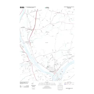
2013 Map of Northumberland
USGS Topo · Published 2013About this map
Northumberland sits at the significant confluence where the W Br Susquehanna River meets the main branch of the Susquehanna River, a geographic focal point defining the local settlement pattern. This area reveals a diverse landscape, from the prominent Montour Ridge to the unique Montandon Sand Dunes near the village of Montandon. The map documents the persistent river-valley infrastructure, including the Rishel Covered Bridge crossing Chillisquaque Cr and the aviation facilities at Sunbury Airport. Smaller communities like Winfield, Potts Grove, and Kapp Heights are situated along the primary transit corridors that follow the water. Recreation and heritage sites are noted through the Shikellamy Overlook and the Chillisquaque Access Area, highlighting the region's relationship with its waterways and topographical landmarks like Blue Hill and The Knobs.
Find a feature on this map
176 named features on this map. Tap any name to fly to it.
Don’t see what you’re looking for? This feature index may not catch every label — zoom into the map to look around manually.
Map Details
Editions of this 2013 Northumberland Map
This is the sole edition of this map. No revisions or reprints were ever made.
Other maps of this area

1892 · Shamokin
USGS Topo · 1:62,500

1893 · Sunbury
USGS Topo · 1:62,500

1893 · Shamokin
USGS Topo · 1:62,500

1924 · Milton
USGS Topo · 1:62,500

1935 · Hughesville
USGS Topo · 1:62,500

1943 · Shamokin
USGS Topo · 1:62,500

1943 · Sunbury
USGS Topo · 1:62,500

1950 · Harrisburg
USGS Topo · 1:250,000

1952 · Shamokin
USGS Topo · 1:62,500

1953 · Hughesville
USGS Topo · 1:62,500
Featured Places
- Sunbury, PA
- Northumberland, PA
- Monroe Township, PA
- Kapp, Point Township
- Turtleville, East Buffalo Township