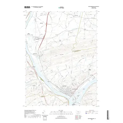
2019 Map of Northumberland
USGS Topo · Published 2019About this map
The West Branch Susquehanna River and the main stem of the Susquehanna River converge at the heart of this Susquehanna Valley landscape, framing the historic boroughs of Northumberland and Sunbury. The terrain is defined by the prominent spine of Montour Ridge and the heights of Shamokin Mtn, with Packers Island sitting at the confluence of the two river branches. This 2019 survey captures a mix of industrial centers and preserved rural landmarks, most notably the Rishel Covered Bridge spanning Chillisquaque Creek.
Find a feature on this map
39 named features on this map. Tap any name to fly to it.
Don’t see what you’re looking for? This feature index may not catch every label — zoom into the map to look around manually.
Map Details
Editions of this 2019 Northumberland Map
This is the sole edition of this map. No revisions or reprints were ever made.
Other maps of this area

1892 · Shamokin
USGS Topo · 1:62,500

1893 · Sunbury
USGS Topo · 1:62,500

1893 · Shamokin
USGS Topo · 1:62,500

1924 · Milton
USGS Topo · 1:62,500

1935 · Hughesville
USGS Topo · 1:62,500

1943 · Shamokin
USGS Topo · 1:62,500

1943 · Sunbury
USGS Topo · 1:62,500

1950 · Harrisburg
USGS Topo · 1:250,000

1952 · Shamokin
USGS Topo · 1:62,500

1953 · Hughesville
USGS Topo · 1:62,500
Featured Places
- Sunbury, PA
- Northumberland, PA
- Monroe Township, PA
- Kapp, Point Township
- Turtleville, East Buffalo Township