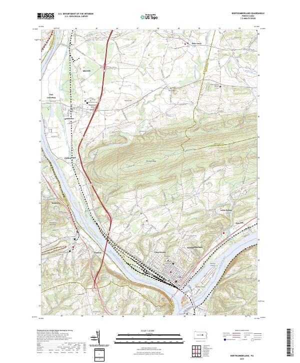
2023 Map of Northumberland
USGS Topo · Published 2023About this map
Northumberland stands at the strategic confluence of the West and North branches of the Susquehanna River, a landscape shaped by river valleys and the prominent Montour Ridge. The map illustrates the concentration of local history around the borough's grid, featuring sites like Quaker Green Cem and the Congregation Beth El Cem. Across the water, Packers Island separates the river channels, while Sunbury Airport sits on the southern bank.
Find a feature on this map
135 named features on this map. Tap any name to fly to it.
Don’t see what you’re looking for? This feature index may not catch every label — zoom into the map to look around manually.
Map Details
Editions of this 2023 Northumberland Map
This is the sole edition of this map. No revisions or reprints were ever made.
Other maps of this area

1892 · Shamokin
USGS Topo · 1:62,500

1893 · Sunbury
USGS Topo · 1:62,500

1893 · Shamokin
USGS Topo · 1:62,500

1924 · Milton
USGS Topo · 1:62,500

1935 · Hughesville
USGS Topo · 1:62,500

1943 · Shamokin
USGS Topo · 1:62,500

1943 · Sunbury
USGS Topo · 1:62,500

1950 · Harrisburg
USGS Topo · 1:250,000

1952 · Shamokin
USGS Topo · 1:62,500

1953 · Hughesville
USGS Topo · 1:62,500