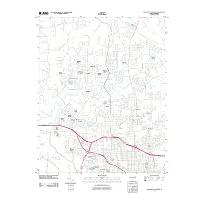
2010 Map of Northwest Durham
USGS Topo · Published 2010About this map
Duke University and its surrounding academic landscape dominate the southern portion of this 2010 study, featuring the Sarah P. Duke Gardens, Clock Tower Court, and specialized facilities like the School of Law. Just north of the university grounds, the historic Duke Homestead preserved a connection to the area's tobacco heritage amidst the growing residential sprawl. The landscape is defined by the winding course of the Eno River and its numerous tributaries, including Sevenmile Creek and Ellerbe Creek, which are punctuated by a series of small dams and reservoirs like the Wake Forest Reservoir and Lake Unity.
Find a feature on this map
78 named features on this map. Tap any name to fly to it.
Don’t see what you’re looking for? This feature index may not catch every label — zoom into the map to look around manually.
Map Details
Editions of this 2010 Northwest Durham Map
This is the sole edition of this map. No revisions or reprints were ever made.
Other maps of this area

1943 · Durham South
USGS Topo · 1:62,500

1946 · Chapel Hill
USGS Topo · 1:24,000

1947 · Chapel Hill
USGS Topo · 1:31,680

1951 · Durham South
USGS Topo · 1:62,500

1951 · Durham North
USGS Topo · 1:62,500

1953 · Raleigh
USGS Topo · 1:250,000

1953 · Greensboro
USGS Topo · 1:250,000

1954 · Greensboro
USGS Topo · 1:250,000

1954 · Raleigh
USGS Topo · 1:250,000

1962 · Greensboro
USGS Topo · 1:250,000