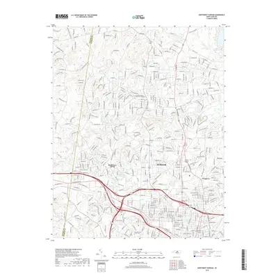
2019 Map of Northwest Durham
USGS Topo · Published 2019About this map
Durham and its northwestern suburbs are defined by a complex network of residential growth and preserved natural corridors. The Eno River winds across the northern landscape, joined by tributaries like Sevenmile Cr and Cabin Br, while the Norfolk Southern rail line and Interstate corridors slice through the southern urban grid. This 2019 survey documents the transition from the city center to the wooded residential developments of the county line, featuring several significant religious and community landmarks including the Duke University Chapel Crypt and the Aldersgate Memorial Garden and Columbarium. Local water features like Huckleberry Spring, Wake Forest Reservoir, and Lake Unity are interspersed among established neighborhoods such as Braggtown, providing a clear record of the area's modern topography and infrastructure near the Orange and Durham County boundary.
Find a feature on this map
380 named features on this map. Tap any name to fly to it.
Don’t see what you’re looking for? This feature index may not catch every label — zoom into the map to look around manually.
Map Details
Editions of this 2019 Northwest Durham Map
This is the sole edition of this map. No revisions or reprints were ever made.
Other maps of this area

1943 · Durham South
USGS Topo · 1:62,500

1946 · Chapel Hill
USGS Topo · 1:24,000

1947 · Chapel Hill
USGS Topo · 1:31,680

1951 · Durham South
USGS Topo · 1:62,500

1951 · Durham North
USGS Topo · 1:62,500

1953 · Raleigh
USGS Topo · 1:250,000

1953 · Greensboro
USGS Topo · 1:250,000

1954 · Greensboro
USGS Topo · 1:250,000

1954 · Raleigh
USGS Topo · 1:250,000

1962 · Greensboro
USGS Topo · 1:250,000