
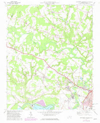
1974 Map of Northwest Goldsboro
USGS Topo · Published 1976About this map
The confluence of the Neuse River and the Little River defines the landscape of western Goldsboro, where the industrial and institutional character of the 1970s is on full display. The southern portion of the map is dominated by the sprawling grounds of Cherry Hospital and the O'Berry Training Sch, situated near the bends of the Neuse. Further west, Quaker Neck Lake and its associated Powerplant mark the river’s utility for regional energy production.
Find a feature on this map
55 named features on this map. Tap any name to fly to it.
Don’t see what you’re looking for? This feature index may not catch every label — zoom into the map to look around manually.
Map Details
Editions of this 1974 Northwest Goldsboro Map
2 editions found
Other maps of this area

1902 · Kenly
USGS Topo · 1:62,500

1903 · Kenly
USGS Topo · 1:62,500

1904 · Wilson
USGS Topo · 1:62,500

1953 · Rocky Mount
USGS Topo · 1:250,000

1953 · Raleigh
USGS Topo · 1:250,000

1954 · Rocky Mount
USGS Topo · 1:250,000

1954 · Raleigh
USGS Topo · 1:250,000

1957 · Goldsboro
USGS Topo · 1:62,500

1974 · Grantham
USGS Topo · 1:24,000
1974 · Princeton
USGS Topo · 1:24,000