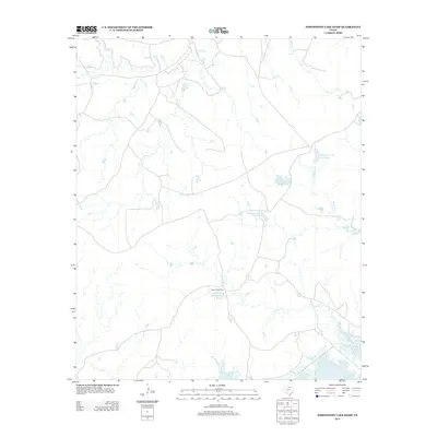
2013 Map of Northwest Lake Kemp
USGS Topo · Published 2013About this map
Indian Creek Pens sits at the heart of this ranching-dominated landscape in Wilbarger County, serving as a rare marker of human industry amidst a network of natural and man-made water sources. The map captures a sophisticated water management system tied to the sprawling land holdings of the region, anchored by the northern reaches of Lake Kemp. A series of reservoirs, including Waggoner Lake Number 1, Waggoner Lake Number 2, Waggoner Lake Number 3, and Waggoner Lake Number 4, are situated along drainage paths such as W Coffee Cr and Indian Cr. This arrangement illustrates the vital importance of water storage for agricultural and ranching operations in this part of Texas. Further north, the terrain is defined by the winding course of Beaver Cr and its tributaries, while isolated features like Lost Lake and Fish Cr dot the southern prairie landscape.
Find a feature on this map
14 named features on this map. Tap any name to fly to it.
Don’t see what you’re looking for? This feature index may not catch every label — zoom into the map to look around manually.
Map Details
Editions of this 2013 Northwest Lake Kemp Map
This is the sole edition of this map. No revisions or reprints were ever made.
Other maps of this area

1954 · Wichita Falls
USGS Topo · 1:250,000

1958 · Wichita Falls
USGS Topo · 1:250,000

1966 · Santa Rosa Lake
USGS Topo · 1:24,000

1966 · Santa Rosa Lake SW
USGS Topo · 1:24,000

1966 · Grayback
USGS Topo · 1:24,000

1966 · Soap Creek
USGS Topo · 1:24,000

1966 · Northeast Lake Kemp
USGS Topo · 1:24,000

1966 · Southeast Lake Kemp
USGS Topo · 1:24,000

1966 · Northwest Lake Kemp
USGS Topo · 1:24,000

1966 · Southwest Lake Kemp
USGS Topo · 1:24,000