
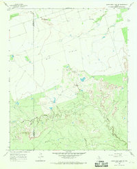
1966 Map of Northwest Lake Kemp
USGS Topo · Published 1969About this map
The rolling plains of North Texas are defined here by the winding drainages that feed the Lake Kemp reservoir, including Beaver Creek and South Beaver Creek in the north and the lower reaches of Indian Creek to the south. Surveyed in the mid-1960s, the landscape is primarily open ranchland, punctuated by the Indian Creek Pens, indicating the local livestock economy of the era. The terrain is a network of draws and seasonal watercourses such as Buck Creek and West Coffee Creek, flowing toward the reservoir. An Indefinite Boundary marks the division between Wilbarger and Baylor Counties through the center of the sheet. The map also captures smaller, distinct water features like Lost Lake and Fish Creek, providing a look at the hydrology of this rural region before modern development or landscape changes altered these drainage patterns.
Find a feature on this map
13 named features on this map. Tap any name to fly to it.
Don’t see what you’re looking for? This feature index may not catch every label — zoom into the map to look around manually.
Map Details
Editions of this 1966 Northwest Lake Kemp Map
This is the sole edition of this map. No revisions or reprints were ever made.
Other maps of this area

1954 · Wichita Falls
USGS Topo · 1:250,000

1958 · Wichita Falls
USGS Topo · 1:250,000

1966 · Santa Rosa Lake
USGS Topo · 1:24,000

1966 · Santa Rosa Lake SW
USGS Topo · 1:24,000

1966 · Grayback
USGS Topo · 1:24,000

1966 · Soap Creek
USGS Topo · 1:24,000

1966 · Northeast Lake Kemp
USGS Topo · 1:24,000

1966 · Southeast Lake Kemp
USGS Topo · 1:24,000

1966 · Southwest Lake Kemp
USGS Topo · 1:24,000
1966 · Santa Rosa Lake NW
USGS Topo · 1:24,000