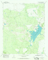
1966 Map of Santa Rosa Lake
USGS Topo · Published 1968About this map
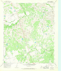
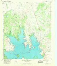
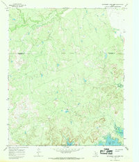
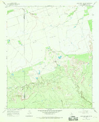
Santa Rosa Lake dominates the central portion of this Wilbarger County landscape, with its shoreline and Spillway captured shortly after the reservoir was established. The map reveals a working ranching and industrial environment in the mid-1960s, characterized by the presence of the Santa Rosa Ranch and specialized outposts like Four Corners Cow Camp and Santa Rosa Pens. A lonely Grave stands on a ridge between Commanche Creek and Lillus Creek, offering a small but significant detail for local historians. In the northern reaches, the active Oil Field and numerous Oil Wells illustrate the region's energy economy, while D's Camp and Cedar Bluff Tank indicate the practical infrastructure needed to manage livestock and land in north-central Texas.
Find a feature on this map
18 named features on this map. Tap any name to fly to it.
Don’t see what you’re looking for? This feature index may not catch every label — zoom into the map to look around manually.
Map Details
Editions of this 1966 Santa Rosa Lake Map
This is the sole edition of this map. No revisions or reprints were ever made.
Other maps of this area

1954 · Wichita Falls
USGS Topo · 1:250,000

1955 · Lawton
USGS Topo · 1:250,000

1958 · Wichita Falls
USGS Topo · 1:250,000
1958 · Davidson
USGS Topo · 1:62,500
1958 · Vernon
USGS Topo · 1:62,500
1966 · Santa Rosa Lake SW
USGS Topo · 1:24,000
1966 · Grayback
USGS Topo · 1:24,000
1966 · Northeast Lake Kemp
USGS Topo · 1:24,000
1966 · Northwest Lake Kemp
USGS Topo · 1:24,000
1966 · Santa Rosa Lake NW
USGS Topo · 1:24,000